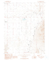
1990 Map of Blue Eagle Springs
USGS Topo · Published 1990About this map
Blue Eagle Springs serves as a vital water source in this arid portion of Railroad Valley, where the landscape is defined by vast basin floors and intricate hydrologic features. The map illustrates a concentration of desert springs along the eastern edge of the valley, including Kate Spring, Soda Spring, and Butterfield Springs. These water points contrast sharply with the expansive Alkali Flat and Bacon Flat to the north and south. Human activity in the area is focused on resource extraction and conservation, evidenced by the presence of a Refinery and numerous Gravel Pits, alongside the protected territory of the Railroad Valley Wildlife Management Area. The network of unimproved roads and numerous drill holes suggests an era of active exploration for minerals or water across this remote basin-and-range terrain.
Find a feature on this map
22 named features on this map. Tap any name to fly to it.
Don’t see what you’re looking for? This feature index may not catch every label — zoom into the map to look around manually.
Map Details
Editions of this 1990 Blue Eagle Springs Map
This is the sole edition of this map. No revisions or reprints were ever made.
Other maps of this area

1956 · Lund
USGS Topo · 1:250,000

1960 · Lund
USGS Topo · 1:250,000

1964 · Blue Eagle Springs
USGS Topo · 1:62,500

1964 · Currant
USGS Topo · 1:62,500

1964 · Troy Canyon
USGS Topo · 1:62,500

1964 · Forest Home
USGS Topo · 1:62,500

1980 · Duckwater
USGS Topo · 1:100,000

1988 · Quinn Canyon Range
USGS Topo · 1:100,000
1990 · Currant
USGS Topo · 1:24,000
1990 · Meteorite Crater
USGS Topo · 1:24,000