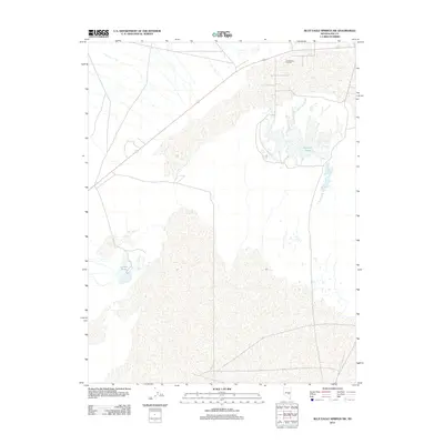
2012 Map of Blue Eagle Springs SW
USGS Topo · Published 2012About this map
Trap Spring Oil Field occupies the northern reaches of this landscape in eastern Nevada, reflecting the industrial character of the Great Basin's high desert. The terrain is defined by a series of aquatic features including Big Well Ponds and Lockes Ponds, which provide vital water sources in an otherwise arid expanse. These ponds, along with the infrastructure for extractive industry, illustrate the human presence in a remote part of Nye County where natural springs and oil resources are the primary drivers of activity. Transport through the region is anchored by the primary thoroughfare, labeled simply as 6, which connects these specialized sites across the basin floor.
Find a feature on this map
4 named features on this map. Tap any name to fly to it.
Don’t see what you’re looking for? This feature index may not catch every label — zoom into the map to look around manually.
Map Details
Editions of this 2012 Blue Eagle Springs SW Map
This is the sole edition of this map. No revisions or reprints were ever made.
Other maps of this area

1956 · Lund
USGS Topo · 1:250,000

1960 · Lund
USGS Topo · 1:250,000

1964 · Blue Eagle Springs
USGS Topo · 1:62,500

1964 · Troy Canyon
USGS Topo · 1:62,500

1968 · Portuguese Mtn
USGS Topo · 1:62,500

1968 · The Wall
USGS Topo · 1:62,500

1968 · Portuguese Mtn
USGS Topo · 1:24,000
1968 · Lockes
USGS Topo · 1:24,000
1968 · The Wall NE
USGS Topo · 1:24,000

1980 · Duckwater
USGS Topo · 1:100,000