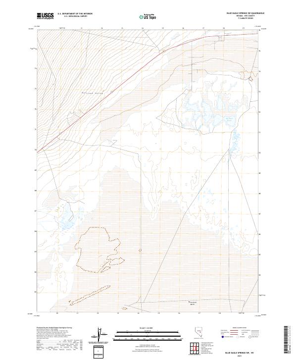
2021 Map of Blue Eagle Springs SW
USGS Topo · Published 2021About this map
Railroad Valley dominates this high-desert basin in Nye County, showing a landscape defined by its hydrology and vast alluvial floor. The presence of Big Well Ponds in the northeast and Butterfield Marsh along the southern edge indicates the critical water sources that have historically supported ranching and ecological life in this arid region. These features illustrate the intermittent nature of the valley’s water systems, where marshes and ponds concentrate in the lowest reaches of the Great Basin terrain. The map meticulously records the public land survey system grid, reflecting the orderly division of the American West through townships and ranges. This 2021 study documents the contemporary state of these wetlands and the sparse road network traversing the valley floor, offering a precise record for those studying the environmental shifts and land management of central Nevada.
Find a feature on this map
9 named features on this map. Tap any name to fly to it.
Don’t see what you’re looking for? This feature index may not catch every label — zoom into the map to look around manually.
Map Details
Editions of this 2021 Blue Eagle Springs SW Map
This is the sole edition of this map. No revisions or reprints were ever made.
Other maps of this area

1956 · Lund
USGS Topo · 1:250,000

1960 · Lund
USGS Topo · 1:250,000

1964 · Blue Eagle Springs
USGS Topo · 1:62,500

1964 · Troy Canyon
USGS Topo · 1:62,500

1968 · Portuguese Mtn
USGS Topo · 1:62,500

1968 · The Wall
USGS Topo · 1:62,500

1968 · Portuguese Mtn
USGS Topo · 1:24,000
1968 · Lockes
USGS Topo · 1:24,000
1968 · The Wall NE
USGS Topo · 1:24,000

1980 · Duckwater
USGS Topo · 1:100,000