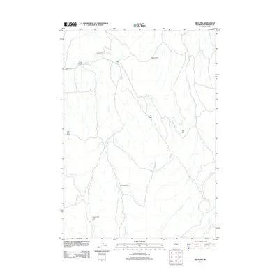
2012 Map of Blue Hill
USGS Topo · Published 2012About this map
Johnson Ranch and Fuller Summer Camp sit within a landscape of deep basins and winding creek beds in this Hot Springs County study. The terrain is defined by the sharp descents of Red Canyon and Ditch Creek Canyon, where seasonal water sources like Winter Spring and Dye Springs provided critical resources for ranching and seasonal habitation. The map tracks the passage of Buffalo Cr as it snakes through Buffalo Basin, revealing a network of drainage systems including Ditch Cr and Alkali Cr that dictate the local topography. This early 21st-century survey documents the persistent ranching footprints and seasonal outposts, such as Antelope Creek Summer Camp, which remain centered on the area's reliable water points and accessible basins like Jack Welch Basin.
Find a feature on this map
19 named features on this map. Tap any name to fly to it.
Don’t see what you’re looking for? This feature index may not catch every label — zoom into the map to look around manually.
Map Details
Editions of this 2012 Blue Hill Map
This is the sole edition of this map. No revisions or reprints were ever made.
Other maps of this area

1951 · Birdseye Pass
USGS Topo · 1:24,000

1952 · Rathbun Ranch
USGS Topo · 1:24,000

1952 · De Pass
USGS Topo · 1:24,000

1952 · Guffy Peak
USGS Topo · 1:24,000

1955 · Thermopolis
USGS Topo · 1:250,000

1955 · Arminto
USGS Topo · 1:250,000

1957 · Rathbun Ranch
USGS Topo · 1:24,000

1958 · Thermopolis
USGS Topo · 1:250,000

1958 · Arminto
USGS Topo · 1:250,000

1960 · Devil Slide
USGS Topo · 1:24,000