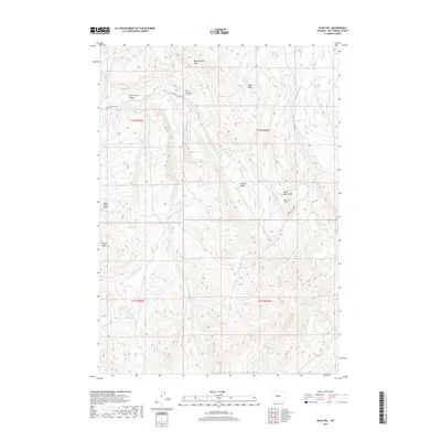
2017 Map of Blue Hill
USGS Topo · Published 2017About this map
Blue Hill stands as a central landmark in this high-desert region of Wyoming, where complex drainage systems and basins define the landscape. The geography is characterized by several large topographical depressions such as Buffalo Basin, Jack Welch Basin, and Grider Basin, which funnel seasonal water through an intricate network of ephemeral streams. Significant hydrological features include Blue Springs Draw, Side Hill Spring, and Bye Springs, indicating the critical role of water sources in this arid environment. Transportation across the area is largely limited to unpaved routes like Buffalo Creek Rd, which skirts the northern edges of Ditch Creek Canyon and Red Canyon. This 2017 survey by the U.S. Geological Survey provides a clear view of the ranching and resource-management landscape, where named features often reflect early settlers or the distinct red-rock geology of the Big Horn Basin vicinity.
Find a feature on this map
23 named features on this map. Tap any name to fly to it.
Don’t see what you’re looking for? This feature index may not catch every label — zoom into the map to look around manually.
Map Details
Editions of this 2017 Blue Hill Map
This is the sole edition of this map. No revisions or reprints were ever made.
Other maps of this area

1951 · Birdseye Pass
USGS Topo · 1:24,000

1952 · Rathbun Ranch
USGS Topo · 1:24,000

1952 · De Pass
USGS Topo · 1:24,000

1952 · Guffy Peak
USGS Topo · 1:24,000

1955 · Thermopolis
USGS Topo · 1:250,000

1955 · Arminto
USGS Topo · 1:250,000

1957 · Rathbun Ranch
USGS Topo · 1:24,000

1958 · Thermopolis
USGS Topo · 1:250,000

1958 · Arminto
USGS Topo · 1:250,000

1960 · Devil Slide
USGS Topo · 1:24,000