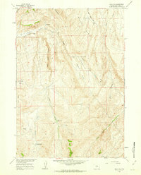
1960 Map of Blue Hill
USGS Topo · Published 1962About this map
Johnson Ranch and localized summer outposts like Fuller Summer Camp anchor this landscape in the Wyoming backcountry during the early 1960s. The terrain is defined by a series of deep drainage systems, most notably Major Basin and the winding Red Canyon. These features illustrate the precarious nature of water management in a high-desert environment, where seasonal flows along the West Fork Kirby Creek and Alkali Creek supported isolated ranching operations.
Find a feature on this map
21 named features on this map. Tap any name to fly to it.
Don’t see what you’re looking for? This feature index may not catch every label — zoom into the map to look around manually.
Map Details
Editions of this 1960 Blue Hill Map
This is the sole edition of this map. No revisions or reprints were ever made.
Other maps of this area

1951 · Birdseye Pass
USGS Topo · 1:24,000

1952 · Rathbun Ranch
USGS Topo · 1:24,000

1952 · De Pass
USGS Topo · 1:24,000

1952 · Guffy Peak
USGS Topo · 1:24,000

1955 · Thermopolis
USGS Topo · 1:250,000

1955 · Arminto
USGS Topo · 1:250,000

1957 · Rathbun Ranch
USGS Topo · 1:24,000

1958 · Thermopolis
USGS Topo · 1:250,000

1958 · Arminto
USGS Topo · 1:250,000

1960 · Devil Slide
USGS Topo · 1:24,000