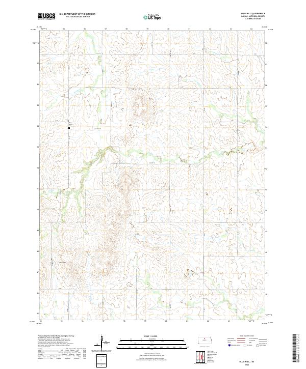
2022 Map of Blue Hill
USGS Topo · Published 2022About this map
Blue Hills define the southern landscape of this Mitchell County region, where the terrain breaks into a complex system of drainage basins. The area is marked by a network of seasonal and perennial streams, including the central course of Salt Cr and the northern reaches of Walnut Cr and Antelope Cr. This rural expanse is organized by a precise grid of township roads and trails, reflecting the enduring legacy of the Public Land Survey System across T8S and T9S. Local history is anchored at the Rose Valley Cem along 170 Rd, a key landmark for genealogists tracing early families in this part of Kansas. The map captures the agricultural character of the plains, where naming conventions for waterways like Cole Cr and Rock Cr suggest the natural features encountered by early settlers.
Find a feature on this map
31 named features on this map. Tap any name to fly to it.
Don’t see what you’re looking for? This feature index may not catch every label — zoom into the map to look around manually.
Map Details
Editions of this 2022 Blue Hill Map
This is the sole edition of this map. No revisions or reprints were ever made.
Other maps of this area

1894 · Beloit
USGS Topo · 1:125,000

1953 · Solomon Rapids
USGS Topo · 1:24,000

1953 · Waconda Springs
USGS Topo · 1:24,000

1953 · Glen Elder South
USGS Topo · 1:24,000

1955 · Beloit
USGS Topo · 1:250,000

1959 · Beloit
USGS Topo · 1:250,000

1967 · Hunter
USGS Topo · 1:24,000

1968 · Beloit SW
USGS Topo · 1:24,000

1968 · Lincoln NW
USGS Topo · 1:24,000
1968 · Ash Grove
USGS Topo · 1:24,000