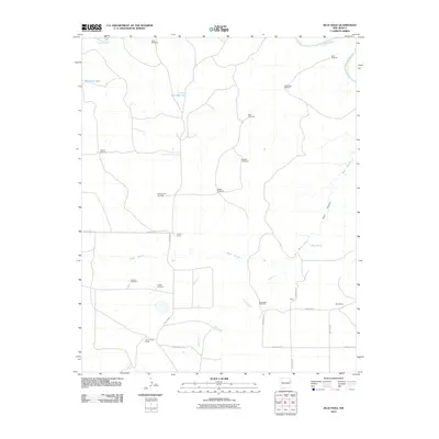
2010 Map of Blue Hole
USGS Topo · Published 2010About this map
The Canadian River cuts across the northern reaches of this high plains landscape, defining a terrain shaped by water management and ranching. The distribution of life here is traced through a network of water sources, from the namesake Blue Hole to numerous family-named landmarks like Shaffer Windmill and Granny Windmill. This map documents a specialized ranching economy where place names are tied directly to livestock infrastructure, including Mesquital Tank and the East Side Tank.
Find a feature on this map
30 named features on this map. Tap any name to fly to it.
Don’t see what you’re looking for? This feature index may not catch every label — zoom into the map to look around manually.
Map Details
Editions of this 2010 Blue Hole Map
This is the sole edition of this map. No revisions or reprints were ever made.
Other maps of this area

1954 · Tucumcari
USGS Topo · 1:250,000

1958 · Tucumcari
USGS Topo · 1:250,000

1962 · Logan
USGS Topo · 1:62,500

1968 · Porter
USGS Topo · 1:24,000

1968 · Blue Hole
USGS Topo · 1:24,000

1968 · Bard
USGS Topo · 1:24,000

1968 · Glenrio
USGS Topo · 1:24,000

1968 · Cammak Camp
USGS Topo · 1:24,000

1968 · Sanchez Springs
USGS Topo · 1:24,000
1968 · Martin Draw
USGS Topo · 1:24,000