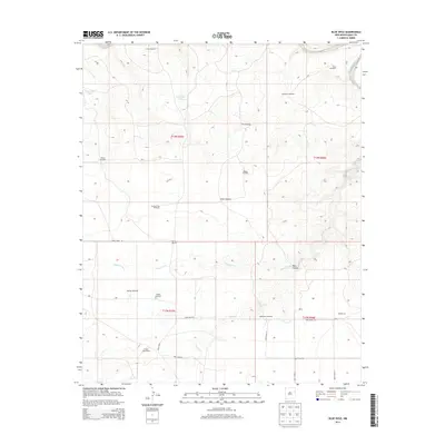
2013 Map of Blue Hole
USGS Topo · Published 2013About this map
High plains ranching and water management define this portion of Quay County in the early 21st century. The landscape is dominated by a systematic grid of section lines and gravel roads, including Quay Road 70 and Quay Road H, which serve isolated family holdings like Collins Ranch and the Cooper-Trew Ranch. This environment reveals the critical importance of water infrastructure in New Mexico's arid climate, evidenced by the high density of named windmills such as Granny Windmill, Shaffer Windmill, and Ivory Windmill. Local topography is punctuated by drainage features like Rana Arroyo and Frost Cr, which carve through the terrain toward Rana Canyon. Named locations such as Pharis and Dougherty provide reference points for genealogists and local historians tracking the development of these rural communities.
Find a feature on this map
33 named features on this map. Tap any name to fly to it.
Don’t see what you’re looking for? This feature index may not catch every label — zoom into the map to look around manually.
Map Details
Editions of this 2013 Blue Hole Map
This is the sole edition of this map. No revisions or reprints were ever made.
Other maps of this area

1954 · Tucumcari
USGS Topo · 1:250,000

1958 · Tucumcari
USGS Topo · 1:250,000

1962 · Logan
USGS Topo · 1:62,500

1968 · Porter
USGS Topo · 1:24,000

1968 · Blue Hole
USGS Topo · 1:24,000

1968 · Bard
USGS Topo · 1:24,000

1968 · Glenrio
USGS Topo · 1:24,000

1968 · Cammak Camp
USGS Topo · 1:24,000

1968 · Sanchez Springs
USGS Topo · 1:24,000
1968 · Martin Draw
USGS Topo · 1:24,000