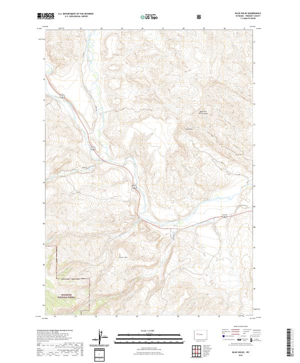
2021 Map of Blue Holes
USGS Topo · Published 2021About this map
Wind River and its numerous tributaries dominate this Fremont County landscape, carving through a high-elevation basin where the Shoshone National Forest meets active ranching and agricultural lands. The eponymous Blue Holes and adjacent Blue Hole Cr define the western portion of the sheet, while the prominent plateau of Table Mtn rises to the south.
Find a feature on this map
22 named features on this map. Tap any name to fly to it.
Don’t see what you’re looking for? This feature index may not catch every label — zoom into the map to look around manually.
Map Details
Editions of this 2021 Blue Holes Map
This is the sole edition of this map. No revisions or reprints were ever made.
Other maps of this area

1904 · Kirwin
USGS Topo · 1:125,000

1905 · Younts Peak
USGS Topo · 1:125,000

1906 · Kirwin
USGS Topo · 1:125,000

1907 · Younts Peak
USGS Topo · 1:125,000

1909 · Fremont Peak
USGS Topo · 1:125,000

1952 · Wilderness
USGS Topo · 1:24,000

1952 · Hays Park
USGS Topo · 1:24,000

1952 · Blue Holes
USGS Topo · 1:24,000

1952 · Burris
USGS Topo · 1:24,000

1955 · Thermopolis
USGS Topo · 1:250,000