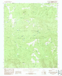
1988 Map of Blue House Mountain
USGS Topo · Published 1988About this map
Fort Apache Indian Reservation land dominates this high-elevation landscape, where dramatic topography rises toward Blue House Mountain and Bear Mountain. The survey reveals a vital network of water management features essential for livestock and settlement in the late 1980s, including numerous named stock tanks such as Grease Bucket Tank, Checker Tank, and the West Tin House Tank.
Find a feature on this map
35 named features on this map. Tap any name to fly to it.
Don’t see what you’re looking for? This feature index may not catch every label — zoom into the map to look around manually.
Map Details
Editions of this 1988 Blue House Mountain Map
This is the sole edition of this map. No revisions or reprints were ever made.
Other maps of this area

1886 · Holbrook
USGS Topo · 1:250,000

1893 · Holbrook
USGS Topo · 1:250,000

1922 · Chrysotile
USGS Topo · 1:125,000

1946 · Blue House Mtn
USGS Topo · 1:62,500

1951 · Blue House Mtn
USGS Topo · 1:62,500

1954 · Holbrook
USGS Topo · 1:250,000

1954 · Mesa
USGS Topo · 1:250,000

1957 · Mesa
USGS Topo · 1:250,000

1957 · Holbrook
USGS Topo · 1:250,000

1958 · Mesa
USGS Topo · 1:250,000