
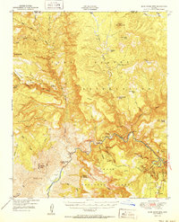
1951 Map of Blue House Mtn
USGS Topo · Published 1951About this map
Sanrace Cliff Dwellings and a separate Cliff Dwelling overlook the deep canyons formed by the Salt River as it winds through this remote reach of the Gila County high country. The 1951 landscape is defined by its deep vertical relief and an active mineral economy, evidenced by the cluster of workings such as the Regal Mine, Canadian Mines, and Apache Mine located along the river's steep banks.
Find a feature on this map
62 named features on this map. Tap any name to fly to it.
Don’t see what you’re looking for? This feature index may not catch every label — zoom into the map to look around manually.
Map Details
Editions of this 1951 Blue House Mtn Map
2 editions found
Other maps of this area

1886 · Holbrook
USGS Topo · 1:250,000

1893 · Holbrook
USGS Topo · 1:250,000

1922 · Chrysotile
USGS Topo · 1:125,000

1946 · Blue House Mtn
USGS Topo · 1:62,500

1949 · McFadden Peak
USGS Topo · 1:62,500

1949 · Rockinstraw Mtn
USGS Topo · 1:62,500

1950 · Rockinstraw Mtn
USGS Topo · 1:62,500

1950 · McFadden Peak
USGS Topo · 1:62,500

1954 · Holbrook
USGS Topo · 1:250,000

1954 · Mesa
USGS Topo · 1:250,000