
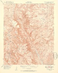
1950 Map of McFadden Peak
USGS Topo · Published 1950About this map
Sierra Ancha dominates this 1950s terrain, where the high ridges of the Tonto National Forest meet the western edge of the Fort Apache Indian Reservation. The landscape is characterized by a network of ranching and early scientific activity, anchored by the Parker Creek Experiment Sta and the Reynolds Cr Ranger Sta. Resource extraction and land management are evident through named sites like the Lucky Strike Mine and Asbestos Pt, while the presence of the Aztec Lodge and Rose Cr Lodge suggest the area's role as a retreat. The complex drainage of Cherry Creek and the dramatic drop of Workman Creek Falls illustrate the high-relief topography of the McFadden Pk area, providing a record of the mid-century infrastructure and family-held land such as the Ellison Ranch and Murphy Ranch.
Find a feature on this map
125 named features on this map. Tap any name to fly to it.
Don’t see what you’re looking for? This feature index may not catch every label — zoom into the map to look around manually.
Map Details
Editions of this 1950 McFadden Peak Map
2 editions found
Other maps of this area

1886 · Holbrook
USGS Topo · 1:250,000

1887 · Verde
USGS Topo · 1:250,000

1892 · Verde
USGS Topo · 1:250,000

1893 · Holbrook
USGS Topo · 1:250,000

1907 · Roosevelt
USGS Topo · 1:125,000

1909 · Four Peaks
USGS Topo · 1:125,000

1912 · Roosevelt
USGS Topo · 1:125,000

1922 · Chrysotile
USGS Topo · 1:125,000

1937 · Diamond Butte
USGS Topo · 1:48,000

1943 · Diamond Butte
USGS Topo · 1:62,500