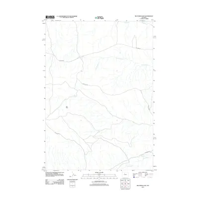
2012 Map of Blue Mesa East
USGS Topo · Published 2012About this map
Blue Mesa dominates this Wyoming landscape, serving as a high-altitude focal point for a network of intermittent drainages and ranch roads. The drainage patterns on this 2012 survey illustrate the natural watershed of Washakie County, where Little Gooseberry Cr and Gooseberry Cr carve through the arid terrain in the north, while Cottonwood Cr defines the southern boundary. These seasonal watercourses are critical lifelines in the High Plains, often punctuated by isolated water sources like Keg Spring. The human imprint is defined by utility-minded infrastructure, including Blue Mesa Rd and Spring Gulch Rd, which follow the contours of the land to connect remote outposts. This map captures the region's character as a sparsely populated high-desert expanse, where the topography dictates the placement of every trail and landmark.
Find a feature on this map
8 named features on this map. Tap any name to fly to it.
Don’t see what you’re looking for? This feature index may not catch every label — zoom into the map to look around manually.
Map Details
Editions of this 2012 Blue Mesa East Map
This is the sole edition of this map. No revisions or reprints were ever made.
Other maps of this area

1914 · Blue Mesa
USGS Topo · 1:62,500

1916 · Blue Mesa
USGS Topo · 1:62,500

1945 · Kirby
USGS Topo · 1:62,500

1946 · Kirby
USGS Topo · 1:62,500

1951 · Dutch Nick Flat
USGS Topo · 1:24,000

1951 · Schuster Flats
USGS Topo · 1:24,000

1951 · Dutch Nick Flat SW
USGS Topo · 1:24,000

1955 · Cody
USGS Topo · 1:250,000

1955 · Thermopolis
USGS Topo · 1:250,000

1958 · Cody
USGS Topo · 1:250,000