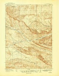
1916 Map of Blue Mesa
USGS Topo · Published 1947About this map
Blue Mesa dominates this 1913-1914 survey of the central Bighorn Basin, a landscape defined by significant watercourse drainage systems and sharp topographical relief. The quadrangle captures the borderlands of Washakie and Hot Springs counties, marked by a distinct Boundary Line that bisects the rugged terrain. Hydrological features provide the primary points of orientation, with the winding paths of Gooseberry Creek, Grass Creek, and Cottonwood Creek cutting through the arid environment. Minor water sources and drainage channels like Harris Spring, Spring Gulch, and Coal Draw suggest the importance of local water management for early ranching or mining interests in this region during the early twentieth century. The map also includes several labeled benchmarks, providing precise elevations across the dissected plateaus and gulches.
Find a feature on this map
12 named features on this map. Tap any name to fly to it.
Don’t see what you’re looking for? This feature index may not catch every label — zoom into the map to look around manually.
Map Details
Editions of this 1916 Blue Mesa Map
2 editions found
Other maps of this area

1913 · Grass Creek Basin
USGS Topo · 1:62,500

1914 · Blue Mesa
USGS Topo · 1:62,500

1915 · Grass Creek Basin
USGS Topo · 1:62,500

1916 · Blue Mesa
USGS Topo · 1:62,500

1945 · Kirby
USGS Topo · 1:62,500

1946 · Kirby
USGS Topo · 1:62,500

1951 · Dutch Nick Flat
USGS Topo · 1:24,000

1951 · Schuster Flats
USGS Topo · 1:24,000

1951 · Dutch Nick Flat SW
USGS Topo · 1:24,000

1951 · Gillies Draw
USGS Topo · 1:24,000