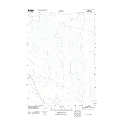
2012 Map of Blue Mesa West
USGS Topo · Published 2012About this map
Grass Cr meanders across the southern landscape of this 2012 survey in Washakie County, defining the drainage patterns of this high-altitude basin. The terrain is characterized by a dense network of intermittent streams and coulees that feed into primary watercourses like Gooseberry Cr, which skims the northern margin of the quadrangle. Transportation through this arid, remote section of Wyoming is limited, anchored primarily by the passage of Blue Mesa Rd across the northern heights. The map reveals a land structured by its hydrology, where the sparse road network follows the gentler gradients between the mesa top and the creek bottoms. This survey by the U.S. Geological Survey captures the area's transition between elevated tablelands and the eroded drainages typical of the region's ranching and resource territory.
Find a feature on this map
3 named features on this map. Tap any name to fly to it.
Don’t see what you’re looking for? This feature index may not catch every label — zoom into the map to look around manually.
Map Details
Editions of this 2012 Blue Mesa West Map
This is the sole edition of this map. No revisions or reprints were ever made.
Other maps of this area

1913 · Grass Creek Basin
USGS Topo · 1:62,500

1914 · Blue Mesa
USGS Topo · 1:62,500

1915 · Grass Creek Basin
USGS Topo · 1:62,500

1916 · Blue Mesa
USGS Topo · 1:62,500

1951 · Dutch Nick Flat
USGS Topo · 1:24,000

1951 · Dutch Nick Flat SW
USGS Topo · 1:24,000

1951 · Gillies Draw
USGS Topo · 1:24,000

1955 · Cody
USGS Topo · 1:250,000

1955 · Thermopolis
USGS Topo · 1:250,000

1958 · Cody
USGS Topo · 1:250,000