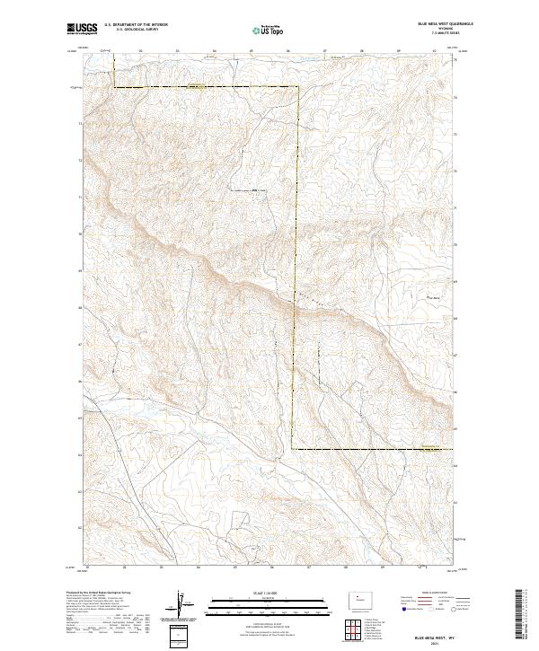
2021 Map of Blue Mesa West
USGS Topo · Published 2021About this map
Washakie and Hot Springs counties meet along a rugged divide characterized by dramatic elevation changes. The land is defined by prominent topographical landmarks like Blue Ridge and Blue Mesa, where deep drainages and high plateaus dominate the landscape. Human intervention in this arid environment is most evident through water management and transit, including the winding course of Perkins Ditch and the primary access provided by Blue Mesa Rd. The map also traces the path of Grass Cr as it carves through the southern sections. This area represents a classic example of high-country ranching and public land management in Wyoming, where the grid of the Public Land Survey System imposes order over the complex, undulating terrain of the Big Horn Basin's western edge.
Find a feature on this map
12 named features on this map. Tap any name to fly to it.
Don’t see what you’re looking for? This feature index may not catch every label — zoom into the map to look around manually.
Map Details
Editions of this 2021 Blue Mesa West Map
This is the sole edition of this map. No revisions or reprints were ever made.
Other maps of this area

1913 · Grass Creek Basin
USGS Topo · 1:62,500

1914 · Blue Mesa
USGS Topo · 1:62,500

1915 · Grass Creek Basin
USGS Topo · 1:62,500

1916 · Blue Mesa
USGS Topo · 1:62,500

1951 · Dutch Nick Flat
USGS Topo · 1:24,000

1951 · Dutch Nick Flat SW
USGS Topo · 1:24,000

1951 · Gillies Draw
USGS Topo · 1:24,000

1955 · Cody
USGS Topo · 1:250,000

1955 · Thermopolis
USGS Topo · 1:250,000

1958 · Cody
USGS Topo · 1:250,000