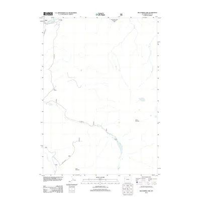
2012 Map of Blue Miner Lake
USGS Topo · Published 2012About this map
Flat Creek Ranch and Teton Valley Ranch anchor this high-elevation landscape in Teton County, where the topography is defined by the massive geological shifts of the Gros Ventre Slide Geological Area. The Gros Ventre River flows across the northern edge near the settlement of Kelly, while the interior is a network of drainage systems including Bierer Cr, Redmond Cr, and the long canyon of Flat Cr. High peaks like Sheep Mountain and Table Mountain overlook the deep incision of Dry Hollow. This 2012 survey illustrates the modern ranching and conservation layout of the region, showing the vital access provided by Flat Creek Rd as it winds through the valley floor to reach remote outpost locations deep within the mountains.
Find a feature on this map
21 named features on this map. Tap any name to fly to it.
Don’t see what you’re looking for? This feature index may not catch every label — zoom into the map to look around manually.
Map Details
Editions of this 2012 Blue Miner Lake Map
This is the sole edition of this map. No revisions or reprints were ever made.
Other maps of this area

1899 · Grand Teton
USGS Topo · 1:125,000

1901 · Grand Teton
USGS Topo · 1:125,000

1902 · Mt Leidy
USGS Topo · 1:125,000

1907 · Gros Ventre
USGS Topo · 1:125,000

1910 · Gros Ventre
USGS Topo · 1:125,000

1931 · Jackson
USGS Topo · 1:125,000

1935 · Jackson
USGS Topo · 1:125,000

1955 · Driggs
USGS Topo · 1:250,000

1958 · Driggs
USGS Topo · 1:250,000

1962 · Driggs
USGS Topo · 1:250,000