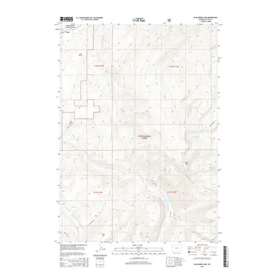
2015 Map of Blue Miner Lake
USGS Topo · Published 2015About this map
Kelly sits at the northwestern edge of this 2015 survey, marking a small point of settlement where the valley meets the rising peaks. The landscape is defined by the high-elevation drainage of Flat Cr and its tributaries, including Bierer Cr and Redmond Cr, which carve through the protected lands of Grand Teton National Park and the Teton National Forest. Notable summits like Sheep Mtn and Table Mtn dominate the southern half of the sheet, providing a detailed view of the alpine topography between Long Hollow and the namesake Blue Miner Lake. The map details the transition from the relatively level terrain near Dry Hollow to the steep, water-carved canyons further east. Navigational landmarks like Sheep Creek Rd and the trail toward Goodwin Lake offer a clear record of access into these Wyoming highlands during the mid-2010s.
Find a feature on this map
21 named features on this map. Tap any name to fly to it.
Don’t see what you’re looking for? This feature index may not catch every label — zoom into the map to look around manually.
Map Details
Editions of this 2015 Blue Miner Lake Map
This is the sole edition of this map. No revisions or reprints were ever made.
Other maps of this area

1899 · Grand Teton
USGS Topo · 1:125,000

1901 · Grand Teton
USGS Topo · 1:125,000

1902 · Mt Leidy
USGS Topo · 1:125,000

1907 · Gros Ventre
USGS Topo · 1:125,000

1910 · Gros Ventre
USGS Topo · 1:125,000

1931 · Jackson
USGS Topo · 1:125,000

1935 · Jackson
USGS Topo · 1:125,000

1955 · Driggs
USGS Topo · 1:250,000

1958 · Driggs
USGS Topo · 1:250,000

1962 · Driggs
USGS Topo · 1:250,000