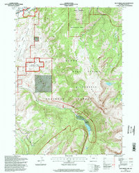
1996 Map of Blue Miner Lake
USGS Topo · Published 1998About this map
Gros Ventre River and the small settlement of Kelly anchor the northern edge of this mid-1990s landscape, illustrating the intersection of ranching life and federal conservation. The map reveals a complex management system, where the National Elk Refuge meets the Teton National Forest and the Gros Ventre Wilderness. Cultural sites like the Teton Valley Ranch and the Rodeo Ground are clearly marked, while the Flat Creek Ranch is positioned deep within the mountainous interior. Natural history is prominent at the Gros Ventre Slide Geological Area, a site of significant tectonic activity. The presence of a Drill Hole and the Grand Teton Nat Park Ditch point to the human engineering required to navigate and utilize this steep terrain. Water bodies such as Blue Miner Lake and Flat Creek drain the surrounding Gros Ventre Mountains, providing the critical resources for the region's diverse wildlife.
Find a feature on this map
28 named features on this map. Tap any name to fly to it.
Don’t see what you’re looking for? This feature index may not catch every label — zoom into the map to look around manually.
Map Details
Editions of this 1996 Blue Miner Lake Map
This is the sole edition of this map. No revisions or reprints were ever made.
Other maps of this area

1899 · Grand Teton
USGS Topo · 1:125,000

1901 · Grand Teton
USGS Topo · 1:125,000

1902 · Mt Leidy
USGS Topo · 1:125,000

1907 · Gros Ventre
USGS Topo · 1:125,000

1910 · Gros Ventre
USGS Topo · 1:125,000

1931 · Jackson
USGS Topo · 1:125,000

1935 · Jackson
USGS Topo · 1:125,000

1955 · Driggs
USGS Topo · 1:250,000

1958 · Driggs
USGS Topo · 1:250,000

1962 · Driggs
USGS Topo · 1:250,000