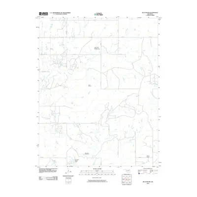
2010 Map of Blue Mound
USGS Topo · Published 2010About this map
The prominent elevation of Blue Mound anchors this 2010 topographic survey of Washington County, Oklahoma. The landscape is defined by a dense network of water management features and seasonal drainages, including the Cotton Coon Mission Site Number 12 Dam and several structures associated with the Dutcher name, such as Dutcher Number 1 Dam and D B Dutcher Number 3 Dam. These small impoundments suggest a local economy focused on ranching and water conservation in a region where water sources are vital.
Find a feature on this map
28 named features on this map. Tap any name to fly to it.
Don’t see what you’re looking for? This feature index may not catch every label — zoom into the map to look around manually.
Map Details
Editions of this 2010 Blue Mound Map
This is the sole edition of this map. No revisions or reprints were ever made.
Other maps of this area

1901 · Nowata
USGS Topo · 1:125,000

1914 · Nowata
USGS Topo · 1:125,000

1954 · Tulsa
USGS Topo · 1:250,000

1958 · Tulsa
USGS Topo · 1:250,000

1963 · Tulsa
USGS Topo · 1:250,000
1971 · Bartlesville South
USGS Topo · 1:24,000
1971 · Bartlesville North
USGS Topo · 1:24,000

1972 · Blue Mound
USGS Topo · 1:24,000
1972 · Elliott
USGS Topo · 1:24,000

1972 · Nowata West
USGS Topo · 1:24,000