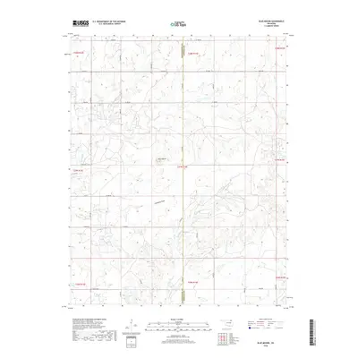
2018 Map of Blue Mound
USGS Topo · Published 2018About this map
Blue Mound serves as the namesake landmark for this portion of northeastern Oklahoma, situated along the border of Washington and Nowata counties. The landscape is defined by an intricate network of drainage systems, most notably the meandering Hogshooter Cr and Limestone Draw. These waterways dictate the local geography, carving through the terrain where cattle ranching and rural homesteads are connected by a rigid grid of section-line roads such as 4 Mile Rd and Durham Rd.
Find a feature on this map
46 named features on this map. Tap any name to fly to it.
Don’t see what you’re looking for? This feature index may not catch every label — zoom into the map to look around manually.
Map Details
Editions of this 2018 Blue Mound Map
This is the sole edition of this map. No revisions or reprints were ever made.
Other maps of this area

1901 · Nowata
USGS Topo · 1:125,000

1914 · Nowata
USGS Topo · 1:125,000

1954 · Tulsa
USGS Topo · 1:250,000

1958 · Tulsa
USGS Topo · 1:250,000

1963 · Tulsa
USGS Topo · 1:250,000
1971 · Bartlesville South
USGS Topo · 1:24,000
1971 · Bartlesville North
USGS Topo · 1:24,000

1972 · Blue Mound
USGS Topo · 1:24,000
1972 · Elliott
USGS Topo · 1:24,000

1972 · Nowata West
USGS Topo · 1:24,000