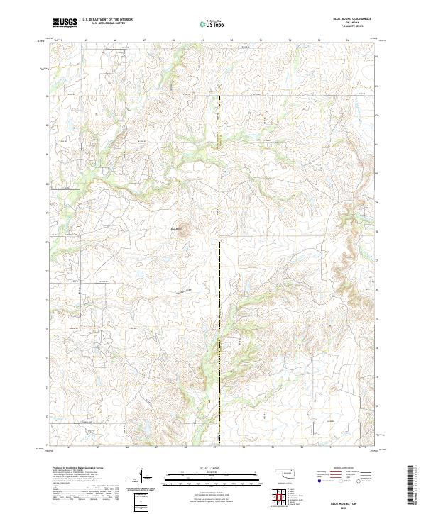
2022 Map of Blue Mound
USGS Topo · Published 2022About this map
The rolling prairies along the Washington and Nowata county line are defined by a complex network of waterways and subtle topographic landmarks. The map’s namesake, Blue Mound, stands as a prominent elevation point overlooking the surrounding drainage basins. To its south, the distinctive Limestone Draw cuts through the landscape, feeding into a dense system of creeks that historically shaped the ranching and agricultural potential of this region.
Find a feature on this map
44 named features on this map. Tap any name to fly to it.
Don’t see what you’re looking for? This feature index may not catch every label — zoom into the map to look around manually.
Map Details
Editions of this 2022 Blue Mound Map
This is the sole edition of this map. No revisions or reprints were ever made.
Other maps of this area

1901 · Nowata
USGS Topo · 1:125,000

1914 · Nowata
USGS Topo · 1:125,000

1954 · Tulsa
USGS Topo · 1:250,000

1958 · Tulsa
USGS Topo · 1:250,000

1963 · Tulsa
USGS Topo · 1:250,000
1971 · Bartlesville South
USGS Topo · 1:24,000
1971 · Bartlesville North
USGS Topo · 1:24,000

1972 · Blue Mound
USGS Topo · 1:24,000
1972 · Elliott
USGS Topo · 1:24,000

1972 · Nowata West
USGS Topo · 1:24,000