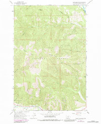
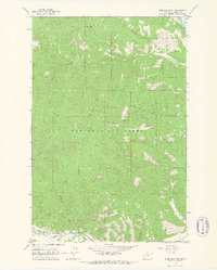
1964 Map of Blue Mountain
USGS Topo · Published 1983About this map
Lolo National Forest dominates the terrain south of the Clark Fork river, showcasing a landscape defined by deep gulches and steep ridgelines. The interior is accessed by the Grave Creek Jeep Trail and various secondary paths, leading past landmarks such as the Lookout Tower atop Blue Mountain and the Chickaman Mine near Chickaman Creek. Along the northern edge, a Gaging Sta monitors the river, while the southern border is traced by Lolo Creek. This 1960s-era survey captures the area before modern expansion, when land use was largely centered on resource extraction and forestry. Numerous family-named features like O'Brien Creek, Hollensteiner Gulch, and Westerman Gulch indicate the early influence of homesteaders and local figures on the geography of Missoula County.
Find a feature on this map
30 named features on this map. Tap any name to fly to it.
Don’t see what you’re looking for? This feature index may not catch every label — zoom into the map to look around manually.
Map Details
Editions of this 1964 Blue Mountain Map
3 editions found
Other maps of this area

1912 · Missoula
USGS Topo · 1:125,000

1956 · Hamilton
USGS Topo · 1:250,000

1959 · Hamilton
USGS Topo · 1:250,000

1960 · Hamilton
USGS Topo · 1:250,000

1963 · Primrose
USGS Topo · 1:24,000

1964 · Hamilton
USGS Topo · 1:250,000
1964 · Diamond Point
USGS Topo · 1:24,000

1964 · Dick Creek
USGS Topo · 1:24,000
1964 · Northwest Missoula
USGS Topo · 1:24,000
1964 · Blue Mountain
USGS Topo · 1:24,000