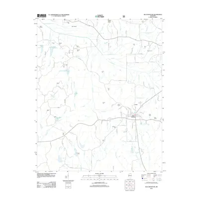
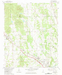
2012 Map of Blue Mountain
USGS Topo · Published 2012About this map
Blue Mountain serves as the central hub of this northern Mississippi landscape, characterized by its network of creeks and small hills. The area exhibits a dense concentration of historical markers, particularly cemeteries like Union Hill Cem and Flat Rock Cem, which offer significant value for genealogical research. The topography is defined by the headwaters of several drainages, including the Tippah River and Hell Cr, which cut through the terrain near landmarks such as Bald Knob and Banana Hill. Settlement patterns appear concentrated around the small community of Lowrey and the various hills like Beulah Hill and Minter Hill. The presence of the Ripley Airport in the northeastern corner suggests modern transportation infrastructure adjacent to more traditional rural landmarks, while bodies of water like Wood Duck Lake and Godwin Lake punctuate the drainage basins between the numerous county roads.
Find a feature on this map
121 named features on this map. Tap any name to fly to it.
Don’t see what you’re looking for? This feature index may not catch every label — zoom into the map to look around manually.
Map Details
Editions of this 2012 Blue Mountain Map
This is the sole edition of this map. No revisions or reprints were ever made.
Other maps of this area

1950 · Ashland
USGS Topo · 1:62,500

1951 · Walnut
USGS Topo · 1:62,500

1955 · Ripley
USGS Topo · 1:62,500

1955 · Blue Mountain
USGS Topo · 1:62,500

1956 · Tupelo
USGS Topo · 1:250,000

1958 · Tupelo
USGS Topo · 1:250,000
1982 · Keownville
USGS Topo · 1:24,000
1982 · Ripley
USGS Topo · 1:24,000
1982 · Blue Mountain
USGS Topo · 1:24,000
1982 · Myrtle
USGS Topo · 1:24,000