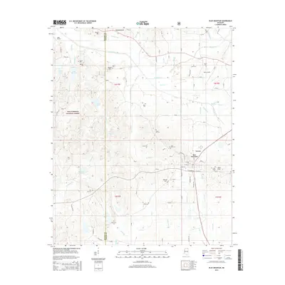
2015 Map of Blue Mountain
USGS Topo · Published 2015About this map
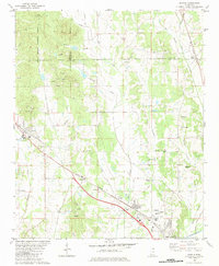
Blue Mountain and the Blue Mtn Coll campus serve as the focal point of this northern Mississippi landscape, situated at the edge of the Holly Springs National Forest. The town's layout is shaped by the BNSF Railway, which cuts a path past Lowrey and Ripley Airport. To the west and north, a network of family-named settlements like Gravestown, Beulah Hill, and Minter Hill suggests the area's deep agricultural and community roots.
Find a feature on this map
89 named features on this map. Tap any name to fly to it.
Don’t see what you’re looking for? This feature index may not catch every label — zoom into the map to look around manually.
Map Details
Editions of this 2015 Blue Mountain Map
This is the sole edition of this map. No revisions or reprints were ever made.
Other maps of this area

1950 · Ashland
USGS Topo · 1:62,500

1951 · Walnut
USGS Topo · 1:62,500

1955 · Ripley
USGS Topo · 1:62,500

1955 · Blue Mountain
USGS Topo · 1:62,500

1956 · Tupelo
USGS Topo · 1:250,000

1958 · Tupelo
USGS Topo · 1:250,000
1982 · Keownville
USGS Topo · 1:24,000
1982 · Ripley
USGS Topo · 1:24,000
1982 · Blue Mountain
USGS Topo · 1:24,000
1982 · Myrtle
USGS Topo · 1:24,000