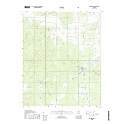
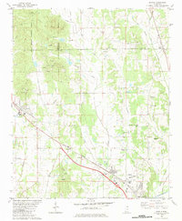
2018 Map of Blue Mountain
USGS Topo · Published 2018About this map
Blue Mountain sits at the heart of this landscape, dominated by the campus of Blue Mtn College and the local commercial hub. The terrain is marked by distinct rises like Bald Knob and Banana Hill, while the eastern portion of the Holly Springs National Forest covers much of the western half. A dense network of rural roads, including Bethel Rd and Flat Rock Rd, connects family-named landmarks and numerous burial sites such as White Cem, Rutherford Cem, and Union Hill Cem. To the north, the Tippah River and its varied tributaries like Hell Cr and North Tippah Cr define the drainage patterns of the county. Near the northern boundary, the settlement of Gravestown and the Ripley Airport highlight the area's mix of traditional rural crossroads and modern infrastructure.
Find a feature on this map
119 named features on this map. Tap any name to fly to it.
Don’t see what you’re looking for? This feature index may not catch every label — zoom into the map to look around manually.
Map Details
Editions of this 2018 Blue Mountain Map
This is the sole edition of this map. No revisions or reprints were ever made.
Other maps of this area

1950 · Ashland
USGS Topo · 1:62,500

1951 · Walnut
USGS Topo · 1:62,500

1955 · Ripley
USGS Topo · 1:62,500

1955 · Blue Mountain
USGS Topo · 1:62,500

1956 · Tupelo
USGS Topo · 1:250,000

1958 · Tupelo
USGS Topo · 1:250,000
1982 · Keownville
USGS Topo · 1:24,000
1982 · Ripley
USGS Topo · 1:24,000
1982 · Blue Mountain
USGS Topo · 1:24,000
1982 · Myrtle
USGS Topo · 1:24,000