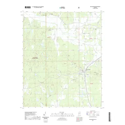
2021 Map of Blue Mountain
USGS Topo · Published 2021About this map
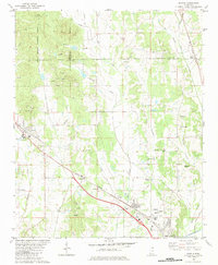
Blue Mountain College serves as a central landmark for this Tippah County community, situated near the headwaters of several notable streams including Tippah River and Hell Creek. The landscape transition is evident where the eastern edge of the Holly Springs National Forest meets a series of prominent elevations like Bald Knob, Banana Hill, and Minter Hill. This survey reveals a dense concentration of family and community burial grounds, including the Duncan, Rutherford, and Marvin cemeteries, which offer significant value for genealogical research in northern Mississippi. Settlement patterns are largely concentrated along the higher ground of the divide, with smaller communities like Lowrey and Gravestown connected by a network of county roads that navigate the complex drainage systems of Dean Creek and South Tippah Creek.
Find a feature on this map
111 named features on this map. Tap any name to fly to it.
Don’t see what you’re looking for? This feature index may not catch every label — zoom into the map to look around manually.
Map Details
Editions of this 2021 Blue Mountain Map
This is the sole edition of this map. No revisions or reprints were ever made.
Other maps of this area

1950 · Ashland
USGS Topo · 1:62,500

1951 · Walnut
USGS Topo · 1:62,500

1955 · Ripley
USGS Topo · 1:62,500

1955 · Blue Mountain
USGS Topo · 1:62,500

1956 · Tupelo
USGS Topo · 1:250,000

1958 · Tupelo
USGS Topo · 1:250,000
1982 · Keownville
USGS Topo · 1:24,000
1982 · Ripley
USGS Topo · 1:24,000
1982 · Blue Mountain
USGS Topo · 1:24,000
1982 · Myrtle
USGS Topo · 1:24,000