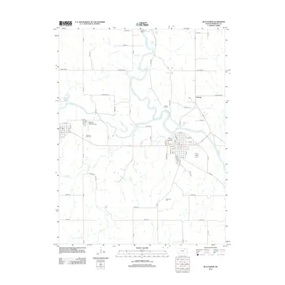
2012 Map of Blue Rapids
USGS Topo · Published 2012About this map
The confluence of the Big Blue River and the Little Blue River dominates the landscape of this 2012 survey in Marshall County. The area is rich in overland history, featuring the Independence Crossing and the nearby Alcove Spring, key landmarks for travelers moving through the Kansas territory. This intersection of waterways created a natural hub for early settlement and modern agricultural development.
Find a feature on this map
55 named features on this map. Tap any name to fly to it.
Don’t see what you’re looking for? This feature index may not catch every label — zoom into the map to look around manually.
Map Details
Editions of this 2012 Blue Rapids Map
This is the sole edition of this map. No revisions or reprints were ever made.
Other maps of this area

1889 · Marysville
USGS Topo · 1:125,000

1894 · Marysville
USGS Topo · 1:125,000

1955 · Manhattan
USGS Topo · 1:250,000

1956 · Manhattan
USGS Topo · 1:250,000

1957 · Manhattan
USGS Topo · 1:250,000

1966 · Marysville
USGS Topo · 1:24,000

1966 · Hanover SE
USGS Topo · 1:24,000

1966 · Home
USGS Topo · 1:24,000
1968 · Blue Rapids SE
USGS Topo · 1:24,000
1968 · Blue Rapids NE
USGS Topo · 1:24,000