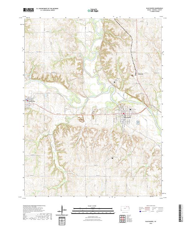
2022 Map of Blue Rapids
USGS Topo · Published 2022About this map
The Big Blue River and Little Blue River converge in this section of Marshall County, shaping the development of Blue Rapids and Waterville. These river valleys dictate the placement of local infrastructure, from the grid of Waterville along E Commercial St to the larger residential layout of Blue Rapids. Historic sites of local significance include Alcove Spring to the north and a series of rural burial grounds such as Prospect Hill Cem, Fairmont Cem, and Greenwood Cem. The landscape is a network of section-line roads like Sunflower Rd and Yonder Rd that connect the small settlements and peripheral sites like Bestwall. To the west, the reservoir of Idlewild Lake provides a distinct hydrological feature amidst the creek systems of Fawn Cr and Elm Cr.
Find a feature on this map
41 named features on this map. Tap any name to fly to it.
Don’t see what you’re looking for? This feature index may not catch every label — zoom into the map to look around manually.
Map Details
Editions of this 2022 Blue Rapids Map
This is the sole edition of this map. No revisions or reprints were ever made.
Other maps of this area

1889 · Marysville
USGS Topo · 1:125,000

1894 · Marysville
USGS Topo · 1:125,000

1955 · Manhattan
USGS Topo · 1:250,000

1956 · Manhattan
USGS Topo · 1:250,000

1957 · Manhattan
USGS Topo · 1:250,000

1966 · Marysville
USGS Topo · 1:24,000

1966 · Hanover SE
USGS Topo · 1:24,000

1966 · Home
USGS Topo · 1:24,000
1968 · Blue Rapids SE
USGS Topo · 1:24,000
1968 · Blue Rapids NE
USGS Topo · 1:24,000