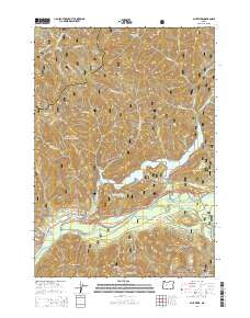
2014 Map of Blue River
USGS Topo · Published 2014About this map
The settlement of Blue River sits at the confluence of its namesake waterway and the McKenzie River, serving as a gateway to the mountainous terrain of the Willamette National Forest. This 2014 survey documents a landscape defined by significant elevation changes, from the prominent heights of Gold Hill and Buck Mtn down to the reservoir waters of Blue River Lake. The mapping reveals a complex network of forest service routes, including the Natl Forest Develop Road 15 Rd, which provides access to the high ridges.
Find a feature on this map
44 named features on this map. Tap any name to fly to it.
Don’t see what you’re looking for? This feature index may not catch every label — zoom into the map to look around manually.
Map Details
Editions of this 2014 Blue River Map
This is the sole edition of this map. No revisions or reprints were ever made.
Other maps of this area

1934 · Mc Kenzie Bridge
USGS Topo · 1:96,000

1940 · Mc Kenzie Bridge
USGS Topo · 1:125,000

1953 · Salem
USGS Topo · 1:250,000

1954 · Salem
USGS Topo · 1:250,000

1955 · Blue River
USGS Topo · 1:62,500

1955 · Cascadia
USGS Topo · 1:62,500

1955 · Echo Mountain
USGS Topo · 1:62,500

1955 · Mc Kenzie Bridge
USGS Topo · 1:62,500

1960 · Salem
USGS Topo · 1:250,000

1962 · Salem
USGS Topo · 1:250,000