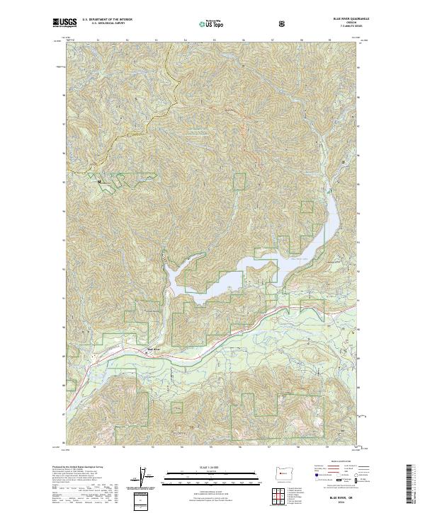
2024 Map of Blue River
USGS Topo · Published 2024About this map
Blue River sits at the confluence of several mountain waterways, dominated by the wide expanse of Blue River Lake and the winding McKenzie River. This 2024 survey captures a landscape defined by the rugged topography of the Cascade Range and the boundaries of the Willamette National Forest. Geologists and local historians will note distinctive landmarks like Thors Hammer and the high elevations of Buck Mtn and Gold Hill. The map provides specific points of interest for genealogical research, such as the isolated Renfrew Grave and nearby Renfrew Spring. The drainage patterns are intricate, with Quartz Creek and the South Fork McKenzie River cutting deep valleys through Lookout Ridge. Infrastructure is concentrated along the river corridor, where Blue River Rd and the local Post Office serve the small settlement, reflecting the area's continued role as a gateway to the forest interior.
Find a feature on this map
39 named features on this map. Tap any name to fly to it.
Don’t see what you’re looking for? This feature index may not catch every label — zoom into the map to look around manually.
Map Details
Editions of this 2024 Blue River Map
This is the sole edition of this map. No revisions or reprints were ever made.
Other maps of this area

1934 · Mc Kenzie Bridge
USGS Topo · 1:96,000

1940 · Mc Kenzie Bridge
USGS Topo · 1:125,000

1953 · Salem
USGS Topo · 1:250,000

1954 · Salem
USGS Topo · 1:250,000

1955 · Blue River
USGS Topo · 1:62,500

1955 · Cascadia
USGS Topo · 1:62,500

1955 · Echo Mountain
USGS Topo · 1:62,500

1955 · Mc Kenzie Bridge
USGS Topo · 1:62,500

1960 · Salem
USGS Topo · 1:250,000

1962 · Salem
USGS Topo · 1:250,000