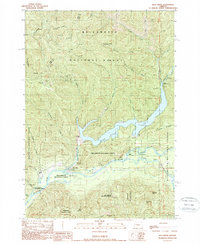
1989 Map of Blue River
USGS Topo · Published 1989About this map
The confluence of the Mc Kenzie River and the Blue River anchors this late-twentieth-century study of the western Cascades. Dominated by the timberlands of the Willamette National Forest, the landscape reflects a transition from early extractive industries to federal land management and recreation. Hard-rock mining history is preserved at the North Star Mine and Lucky Boy Mine, while the nearby Renfrew Grave and Renfrew Spring offer a genealogical trace of early settlers in the rugged terrain of the Linn and Lane county line. The hydrographic character of the region is defined by the Blue River Dam, which creates the sprawling Blue River Lake. This reservoir, along with the South Fork of the Mc Kenzie, supports a network of public access points including the Mona Campground, Delta Campground, and several boat landings. The map also captures several distinctive natural landmarks like Deathball Rock and the prominent Thors Hammer formation.
Find a feature on this map
48 named features on this map. Tap any name to fly to it.
Don’t see what you’re looking for? This feature index may not catch every label — zoom into the map to look around manually.
Map Details
Editions of this 1989 Blue River Map
This is the sole edition of this map. No revisions or reprints were ever made.
Other maps of this area

1934 · Mc Kenzie Bridge
USGS Topo · 1:96,000

1940 · Mc Kenzie Bridge
USGS Topo · 1:125,000

1953 · Salem
USGS Topo · 1:250,000

1954 · Salem
USGS Topo · 1:250,000

1955 · Blue River
USGS Topo · 1:62,500

1955 · Cascadia
USGS Topo · 1:62,500

1955 · Echo Mountain
USGS Topo · 1:62,500

1955 · Mc Kenzie Bridge
USGS Topo · 1:62,500

1960 · Salem
USGS Topo · 1:250,000

1962 · Salem
USGS Topo · 1:250,000