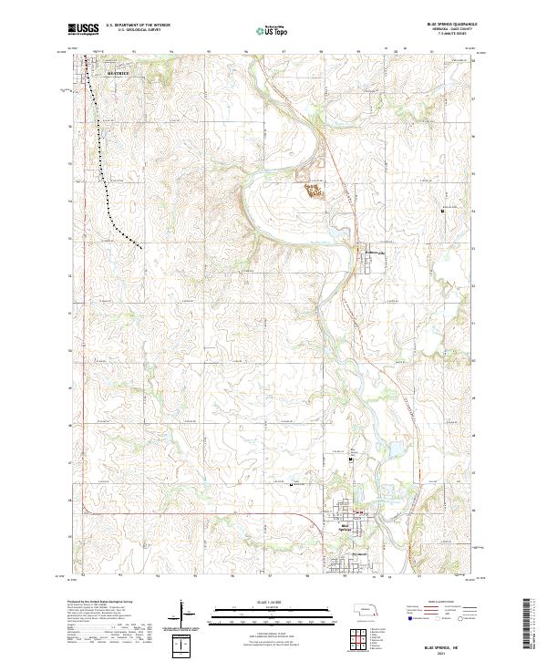
2021 Map of Blue Springs
USGS Topo · Published 2021About this map
The Big Blue River meanders south through this corner of Gage County, anchoring a series of riverfront communities including Holmesville, Blue Springs, and Wymore. The river's industrial legacy is evidenced by the Blue Springs Power Plant Reservoir, while the surrounding prairie landscape is partitioned by a strictly maintained section-line road grid. The presence of several historic burial grounds, such as Saint Marys Cem and Brethren Cem, provides a valuable geographic reference for those researching local family lineages. Stretching across the landscape is the Chief Standing Bear Trl, which follows the historic path of the Big Blue River valley. To the northwest, the map captures the southern outskirts of Beatrice, where suburban development like Country Club Ln meets the agricultural hinterland. Tributaries such as Cedar Cr and Bills Cr drain the undulating terrain into the central river corridor.
Find a feature on this map
54 named features on this map. Tap any name to fly to it.
Don’t see what you’re looking for? This feature index may not catch every label — zoom into the map to look around manually.
Map Details
Editions of this 2021 Blue Springs Map
This is the sole edition of this map. No revisions or reprints were ever made.
Other maps of this area

1955 · Lincoln
USGS Topo · 1:250,000

1957 · Lincoln
USGS Topo · 1:250,000

1957 · Beatrice West
USGS Topo · 1:24,000

1957 · Beatrice East
USGS Topo · 1:24,000

1958 · Lincoln
USGS Topo · 1:250,000

1964 · Blue Springs
USGS Topo · 1:24,000

1970 · Diller NE
USGS Topo · 1:24,000
1970 · Wymore
USGS Topo · 1:24,000
1970 · Barneston
USGS Topo · 1:24,000
1970 · Odell
USGS Topo · 1:24,000