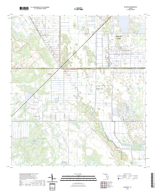
2024 Map of Bluefield
USGS Topo · Published 2024About this map
The St. Lucie and Martin County line divides this landscape of agricultural infrastructure and drainage engineering. The settlement of Bluefield sits at a critical junction of local trails and drainage features, including the County Line Canal which runs east-west across the center of the sheet. To the north, the encroaching suburban grid of Port St. Lucie is visible, centered around specialized aviation and agricultural facilities like the Southern Fruit Groves Airport. Much of the southern portion is defined by the Allapattah Flats, a distinctive wetland environment where named high ground like Boar Hammock and Myer Hammock provide relief from the surrounding Myrtle Slough. Modern conservation efforts are evident in the established paths of the Bluefield Ranch Preserve Trl and the Allapattah Flats Trl, which navigate the network of canals and section lines that have long defined this part of Florida.
Find a feature on this map
28 named features on this map. Tap any name to fly to it.
Don’t see what you’re looking for? This feature index may not catch every label — zoom into the map to look around manually.
Map Details
Editions of this 2024 Bluefield Map
This is the sole edition of this map. No revisions or reprints were ever made.
Other maps of this area

1953 · Okeechobee 4 SW
USGS Topo · 1:24,000

1953 · Okeechobee 4 SE
USGS Topo · 1:24,000

1953 · Okeechobee 1 SE
USGS Topo · 1:24,000

1953 · Okeechobee 4 NE
USGS Topo · 1:24,000

1953 · Okeechobee 4 NW
USGS Topo · 1:24,000

1953 · Okeechobee 1 SW
USGS Topo · 1:24,000

1953 · Indian Town NW
USGS Topo · 1:24,000

1953 · Fort Pierce SW
USGS Topo · 1:24,000

1953 · Indian Town
USGS Topo · 1:24,000

1956 · Fort Pierce
USGS Topo · 1:250,000