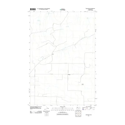
2011 Map of Bluelight
USGS Topo · Published 2011About this map
Bluelight and the surrounding rangeland of Yakima County are defined by a network of seasonal water sources and rural access roads in this 2011 survey. The landscape is marked by numerous vital water points such as Martinet Spring, Matson Spring, and Donohue Spring, which speak to the area's agricultural and ranching history. The presence of Donoho Ranch and labels like Mammoth Tusk Spring suggest a territory where local landmarks are often tied to specific family holdings and paleontological or geographical curiosities. Central to the drainage of this arid region is Glade Creek, which winds through the northern half of the quadrangle. The map captures the organized grid of the valley floor with corridors like County Line Rd and Ferguson Rd, providing a clear record of the modern infrastructure supporting this remote part of Washington state.
Find a feature on this map
23 named features on this map. Tap any name to fly to it.
Don’t see what you’re looking for? This feature index may not catch every label — zoom into the map to look around manually.
Map Details
Editions of this 2011 Bluelight Map
This is the sole edition of this map. No revisions or reprints were ever made.
Other maps of this area

1910 · Zillah
USGS Topo · 1:125,000

1916 · Arlington
USGS Topo · 1:125,000

1950 · Yakima
USGS Topo · 1:250,000

1953 · The Dalles
USGS Topo · 1:250,000

1956 · The Dalles
USGS Topo · 1:250,000

1957 · The Dalles
USGS Topo · 1:250,000

1958 · Yakima
USGS Topo · 1:250,000

1961 · Yakima
USGS Topo · 1:250,000
1962 · Douty Canyon
USGS Topo · 1:24,000
1962 · Crider Valley
USGS Topo · 1:24,000