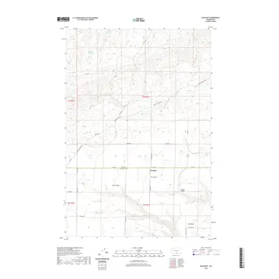
2020 Map of Bluelight
USGS Topo · Published 2020About this map
The small settlement of Bluelight sits at the intersection of Co Line Rd and Bluelight Rd, marking the boundary where Yakima and Klickitat counties meet. This high-plateau landscape is defined by its numerous watering points, which were vital for ranching and travel in this arid portion of south-central Washington. Notable water sources include Mammoth Tusk Spring, Donohue Spring, and Randall Spring, scattered among the high ridges north of the county line.
Find a feature on this map
37 named features on this map. Tap any name to fly to it.
Don’t see what you’re looking for? This feature index may not catch every label — zoom into the map to look around manually.
Map Details
Editions of this 2020 Bluelight Map
This is the sole edition of this map. No revisions or reprints were ever made.
Other maps of this area

1910 · Zillah
USGS Topo · 1:125,000

1916 · Arlington
USGS Topo · 1:125,000

1950 · Yakima
USGS Topo · 1:250,000

1953 · The Dalles
USGS Topo · 1:250,000

1956 · The Dalles
USGS Topo · 1:250,000

1957 · The Dalles
USGS Topo · 1:250,000

1958 · Yakima
USGS Topo · 1:250,000

1961 · Yakima
USGS Topo · 1:250,000
1962 · Douty Canyon
USGS Topo · 1:24,000
1962 · Crider Valley
USGS Topo · 1:24,000