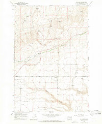
1965 Map of Bluelight
USGS Topo · Published 1966About this map
The Yakima Indian Reservation occupies the northern half of this mid-1960s survey, a landscape defined by deep drainages and isolated water sources. The small settlement of Bluelight sits just south of the Yakima and Klickitat County line, serving as a focal point for the surrounding cattle country. Ranching infrastructure is evident throughout the region, from the Donoho Ranch to various scattered storage bins and water developments.
Find a feature on this map
41 named features on this map. Tap any name to fly to it.
Don’t see what you’re looking for? This feature index may not catch every label — zoom into the map to look around manually.
Map Details
Editions of this 1965 Bluelight Map
This is the sole edition of this map. No revisions or reprints were ever made.
Other maps of this area

1910 · Zillah
USGS Topo · 1:125,000

1916 · Arlington
USGS Topo · 1:125,000

1950 · Yakima
USGS Topo · 1:250,000

1953 · The Dalles
USGS Topo · 1:250,000

1956 · The Dalles
USGS Topo · 1:250,000

1957 · The Dalles
USGS Topo · 1:250,000

1958 · Yakima
USGS Topo · 1:250,000

1961 · Yakima
USGS Topo · 1:250,000
1962 · Douty Canyon
USGS Topo · 1:24,000
1962 · Crider Valley
USGS Topo · 1:24,000