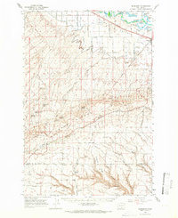
1965 Map of Bluelight
USGS Topo · Published 1966About this map
The Yakima River flows through the northern reaches of this mid-1960s landscape, bordering the settlement of Mabton. This area is defined by the transition from the irrigated agricultural lands of the Yakima Valley to the uplifted ridges of the Yakima Indian Reservation. Irrigation infrastructure is prominent, including the Satus Canal and Reservation Canal, which support the farms north of the ridges.
Find a feature on this map
62 named features on this map. Tap any name to fly to it.
Don’t see what you’re looking for? This feature index may not catch every label — zoom into the map to look around manually.
Map Details
Editions of this 1965 Bluelight Map
This is the sole edition of this map. No revisions or reprints were ever made.
Other maps of this area

1906 · Blalock Island
USGS Topo · 1:125,000

1908 · Blalock Island
USGS Topo · 1:125,000

1910 · Zillah
USGS Topo · 1:125,000

1915 · Prosser
USGS Topo · 1:125,000

1916 · Arlington
USGS Topo · 1:125,000

1917 · Prosser
USGS Topo · 1:125,000

1950 · Yakima
USGS Topo · 1:250,000

1950 · Grandview
USGS Topo · 1:62,500

1951 · Grandview
USGS Topo · 1:62,500

1953 · Pendleton
USGS Topo · 1:250,000