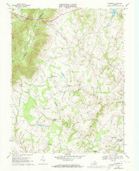
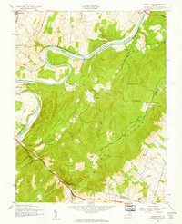
1970 Map of Bluemont
USGS Topo · Published 1973About this map
The Blue Ridge mountains dominate the western edge of this Loudoun County landscape, where the Appalachian Trail follows the high ridgeline and crosses through Snickers Gap. This 1970s record captures a transitional period for these rural Virginia Piedmont communities, showing the established village of Bluemont at the base of the mountains alongside smaller historical settlements like Unison, Bloomfield, and Willisville. The land is characterized by numerous watercourses, including the North Fork Goose Creek and Beaverdam Creek, which dictated the early placement of schools and churches.
Find a feature on this map
33 named features on this map. Tap any name to fly to it.
Don’t see what you’re looking for? This feature index may not catch every label — zoom into the map to look around manually.
Map Details
Editions of this 1970 Bluemont Map
4 editions found
Other maps of this area

1884 · Harpers Ferry
USGS Topo · 1:125,000

1891 · Harpers Ferry
USGS Topo · 1:125,000

1893 · Harpers Ferry
USGS Topo · 1:125,000

1894 · Warrenton
USGS Topo · 1:125,000

1916 · Berryville
USGS Topo · 1:62,500

1933 · Middleburg
USGS Topo · 1:62,500

1939 · Berryville
USGS Topo · 1:48,000

1943 · Bluemont
USGS Topo · 1:24,000
1943 · Ashby Gap
USGS Topo · 1:24,000

1943 · Upperville
USGS Topo · 1:24,000