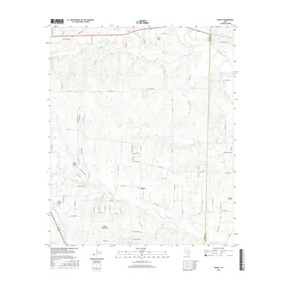
2016 Map of Bluett
USGS Topo · Published 2016About this map
New Fairview and the small community of Bluett anchor this North Texas landscape on the boundary between Wise and Denton counties. The terrain is defined by a dense network of drainages, including Sweetwater Cr to the north and the winding course of Oliver Cr through the center, feeding into local impoundments like Elna Reservoir and Duessen Reservoir. This 2016 survey illustrates a rural region transitioning through residential expansion, marked by numerous private airstrips and farm-based aviation sites.
Find a feature on this map
87 named features on this map. Tap any name to fly to it.
Don’t see what you’re looking for? This feature index may not catch every label — zoom into the map to look around manually.
Map Details
Editions of this 2016 Bluett Map
This is the sole edition of this map. No revisions or reprints were ever made.
Other maps of this area

1924 · Sunset 4-d
USGS Topo · 1:48,000

1930 · Boyd
USGS Topo · 1:62,500

1954 · Sherman
USGS Topo · 1:250,000

1958 · Sherman
USGS Topo · 1:250,000

1959 · Ponder
USGS Topo · 1:24,000

1960 · Decatur
USGS Topo · 1:24,000

1960 · Boyd
USGS Topo · 1:24,000
1960 · Justin
USGS Topo · 1:24,000

1960 · Bluett
USGS Topo · 1:24,000

1960 · Rhome
USGS Topo · 1:24,000