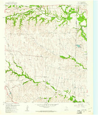
1959 Map of Ponder
USGS Topo · Published 1961About this map
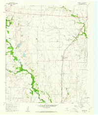
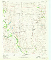
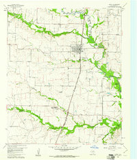
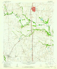
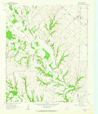
The Gulf Colorado and Santa Fe railroad cuts a straight diagonal through the heart of Denton County in the late 1950s, anchoring the small community of Ponder. This agricultural landscape is defined by the winding course of Denton Creek and its many tributaries, including Morris Branch and Hog Branch. Small rural settlements like Stony and Drop appear as tight clusters of structures, often centered around local landmarks such as Stony Cem or the Brown Chapel. The map reveals a transition toward mid-century infrastructure, noting a Telephone Relay Sta and a Substation alongside traditional rural features like Dan Ranch. Several Gravel Pit operations near Wolf Branch indicate the local extractive industry of the era, while the extensive system of section lines and fence markers illustrates the organized partitioning of the Texas plains.
Find a feature on this map
20 named features on this map. Tap any name to fly to it.
Don’t see what you’re looking for? This feature index may not catch every label — zoom into the map to look around manually.
Map Details
Editions of this 1959 Ponder Map
2 editions found
Other maps of this area

1954 · Sherman
USGS Topo · 1:250,000

1958 · Sherman
USGS Topo · 1:250,000
1960 · Justin
USGS Topo · 1:24,000
1960 · Sanger
USGS Topo · 1:24,000
1960 · Bluett
USGS Topo · 1:24,000
1960 · Argyle
USGS Topo · 1:24,000
1960 · Rhome
USGS Topo · 1:24,000
1960 · Denton West
USGS Topo · 1:24,000
1961 · Slidell
USGS Topo · 1:24,000
1961 · Era SE
USGS Topo · 1:24,000