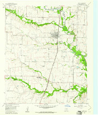
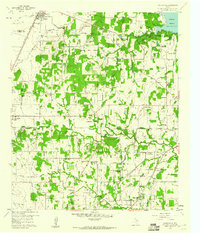
1960 Map of Justin
USGS Topo · Published 1961About this map
Justin sits at the center of this 1960 survey, serving as a railroad hub where the Gulf Colorado and Santa Fe line anchors the local economy. The landscape is defined by the winding drainages of Denton Creek and its tributaries, including Oliver Creek and Elizabeth Creek. These watercourses carve through a terrain dotted with numerous quarries, gravel pits, and a strip mine, indicating a busy mid-century extractive industry.
Find a feature on this map
24 named features on this map. Tap any name to fly to it.
Don’t see what you’re looking for? This feature index may not catch every label — zoom into the map to look around manually.
Map Details
Editions of this 1960 Justin Map
4 editions found
Other maps of this area

1894 · Fort Worth
USGS Topo · 1:125,000

1931 · Grapevine
USGS Topo · 1:62,500

1954 · Dallas
USGS Topo · 1:250,000

1954 · Sherman
USGS Topo · 1:250,000

1955 · Avondale
USGS Topo · 1:24,000

1955 · Keller
USGS Topo · 1:24,000

1955 · Haltom City
USGS Topo · 1:62,500

1958 · Dallas
USGS Topo · 1:250,000

1958 · Sherman
USGS Topo · 1:250,000
1959 · Colleyville
USGS Topo · 1:24,000