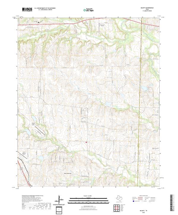
2022 Map of Bluett
USGS Topo · Published 2022About this map
New Fairview serves as a primary settlement node in this North Texas landscape, situated along the boundary between Wise Co and Denton Co. The map reveals a transition from traditional ranching and farming uses to more residential and private aviation activity, evidenced by the cluster of local runways including Allison Farm Airport, Sagebrush Airport, and Heritage Creek Airstrip. The drainage system is particularly intricate, with Denton Creek and Sweetwater Cr cutting across the northern half of the quadrangle while Oliver Cr and Hackberry Cr define the southern terrain.
Find a feature on this map
31 named features on this map. Tap any name to fly to it.
Don’t see what you’re looking for? This feature index may not catch every label — zoom into the map to look around manually.
Map Details
Editions of this 2022 Bluett Map
This is the sole edition of this map. No revisions or reprints were ever made.
Other maps of this area

1924 · Sunset 4-d
USGS Topo · 1:48,000

1930 · Boyd
USGS Topo · 1:62,500

1954 · Sherman
USGS Topo · 1:250,000

1958 · Sherman
USGS Topo · 1:250,000

1959 · Ponder
USGS Topo · 1:24,000

1960 · Decatur
USGS Topo · 1:24,000

1960 · Boyd
USGS Topo · 1:24,000
1960 · Justin
USGS Topo · 1:24,000

1960 · Bluett
USGS Topo · 1:24,000

1960 · Rhome
USGS Topo · 1:24,000