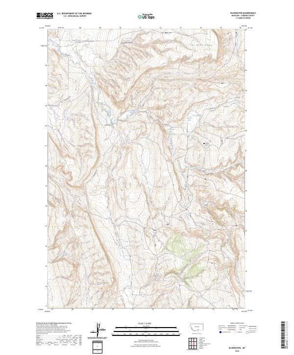
2024 Map of Bluewater
USGS Topo · Published 2024About this map
Bluewater Creek and its various tributaries define the drainage patterns of this high-elevation landscape in Carbon County. The map details a network of water sources essential for life in this arid environment, including Big Bluewater Spring, Bachelder Spring, and Prewet Spring. Human presence is marked by agricultural infrastructure such as the Orchard Ditch and localized access via Bluewater Rd and S Two Bear Rd. For genealogists and local historians, the Teeples Ranch Cem provides a specific point of interest linked to the ranching families of the area. Significant geological formations like Bachelder Canyon and Two Bear Ridge dictate the flow of smaller seasonal streams like Rushwater Creek and Frosty Jack Creek, illustrating the intersection of natural topography and late-twentieth-century land use.
Find a feature on this map
27 named features on this map. Tap any name to fly to it.
Don’t see what you’re looking for? This feature index may not catch every label — zoom into the map to look around manually.
Map Details
Editions of this 2024 Bluewater Map
This is the sole edition of this map. No revisions or reprints were ever made.
Other maps of this area

1954 · Billings
USGS Topo · 1:250,000

1956 · Bridger
USGS Topo · 1:24,000

1956 · Fromberg
USGS Topo · 1:24,000

1956 · Edgar
USGS Topo · 1:24,000

1957 · Billings
USGS Topo · 1:250,000

1958 · Billings
USGS Topo · 1:250,000

1967 · Section House Draw
USGS Topo · 1:24,000

1967 · Bluewater
USGS Topo · 1:24,000
1967 · Pryor NW
USGS Topo · 1:24,000

1969 · Bowler
USGS Topo · 1:24,000