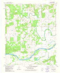
1980 Map of Bluff
USGS Topo · Published 1981About this map
Muddy Boggy Creek winds through the central landscape of this Oklahoma-Texas borderland, eventually feeding into the wide channel of the Red River. The river forms a natural boundary between Choctaw County and Lamar County, where the terrain is marked by numerous lakes and branches including Colbert Lake, Emerson Lake, and the curiously named Dead Man Branch. Small agricultural settlements like Bluff and Duland anchor the local community, supported by local institutions such as St Paul Ch and Mt Sinai Ch. Genealogists will find significant value in the mapped locations of several burial grounds, including Bluff Cem, Reid Cem, and New Macedonia Cem, which are scattered among the fields and creek bends. The area is also defined by large surveyed tracts such as Hunter, Oakes, and Jeter, reflecting the systematic division of the land north of the river.
Find a feature on this map
29 named features on this map. Tap any name to fly to it.
Don’t see what you’re looking for? This feature index may not catch every label — zoom into the map to look around manually.
Map Details
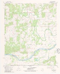
Editions of this 1980 Bluff Map
2 editions found
Other maps of this area

1901 · Antlers
USGS Topo · 1:125,000

1903 · Paris
USGS Topo · 1:125,000

1912 · Antlers
USGS Topo · 1:125,000

1925 · Antlers
USGS Topo · 1:125,000

1948 · Grant
USGS Topo · 1:62,500

1948 · Direct
USGS Topo · 1:62,500

1949 · Direct
USGS Topo · 1:62,500

1949 · Grant
USGS Topo · 1:62,500

1950 · Mcalester
USGS Topo · 1:250,000

1953 · Texarkana
USGS Topo · 1:250,000