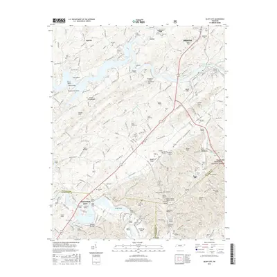
2016 Map of Bluff City
USGS Topo · Published 2016About this map
Boone Lake and the Watauga River dominate this modern topographic landscape, which straddles the borders of Sullivan, Washington, and Carter counties. The area is marked by a dense distribution of family and community burial grounds, such as the Buffalo Christian Church Cem and Saint John Cem, providing a deep record of local genealogy. Several prominent crossings link the communities of Bluff City and Piney Flats, including Pickens Bridge and Rainbow Bridge.
Find a feature on this map
236 named features on this map. Tap any name to fly to it.
Don’t see what you’re looking for? This feature index may not catch every label — zoom into the map to look around manually.
Map Details
Editions of this 2016 Bluff City Map
This is the sole edition of this map. No revisions or reprints were ever made.
Other maps of this area

1891 · Roan Mountain
USGS Topo · 1:125,000

1894 · Roan Mountain
USGS Topo · 1:125,000

1897 · Bristol
USGS Topo · 1:125,000

1902 · Bristol
USGS Topo · 1:125,000

1904 · Roan Mountain
USGS Topo · 1:125,000

1934 · Bristol
USGS Topo · 1:24,000

1935 · Watauga Valley
USGS Topo · 1:48,000

1935 · Blountville
USGS Topo · 1:24,000
1935 · Beaver Creek
USGS Topo · 1:48,000

1935 · Spurgeon
USGS Topo · 1:24,000