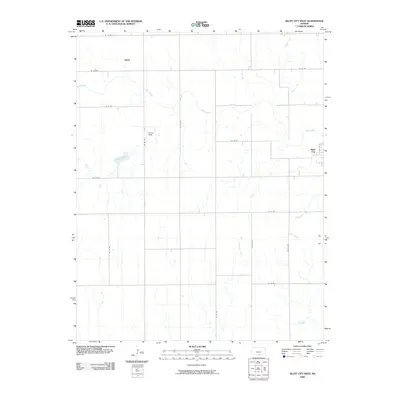
2009 Map of Bluff City West
USGS Topo · Published 2009About this map
Bluff Creek meanders through this agricultural landscape in southern Kansas, serving as the primary drainage for the surrounding prairie. The terrain is defined by a grid of rural roads, such as SE 50 Rd and SE 40 Ave, which facilitate movement between scattered homesteads and the small settlement of Bluff City. To the northwest, the community of Hawk sits near the upper reaches of the creek system. The map documents a sparsely populated region where specialized landmarks like Wilcox Field stand out against the repetitive geometry of section lines. Smaller tributaries, including Wildcat Creek, Crooked Creek, and Baehr Creek, carve shallow paths through the fields, illustrating the subtle hydrology that dictated early settlement patterns and farm placement in this part of Harper County.
Find a feature on this map
23 named features on this map. Tap any name to fly to it.
Don’t see what you’re looking for? This feature index may not catch every label — zoom into the map to look around manually.
Map Details
Editions of this 2009 Bluff City West Map
This is the sole edition of this map. No revisions or reprints were ever made.
Other maps of this area

1889 · Anthony
USGS Topo · 1:125,000

1889 · Caldwell
USGS Topo · 1:125,000

1891 · Anthony
USGS Topo · 1:125,000

1893 · Caldwell
USGS Topo · 1:125,000

1897 · Caldwell
USGS Topo · 1:125,000

1955 · Wichita
USGS Topo · 1:250,000

1955 · Enid
USGS Topo · 1:250,000

1955 · Woodward
USGS Topo · 1:250,000

1955 · Pratt
USGS Topo · 1:250,000

1958 · Enid
USGS Topo · 1:250,000