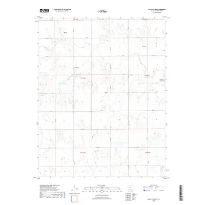
2018 Map of Bluff City West
USGS Topo · Published 2018About this map
Bluff City sits on the eastern edge of this Harper County landscape, where the agricultural grid of south-central Kansas meets a complex network of prairie waterways. The terrain is defined by the winding course of Bluff Cr, which cuts centrally across the quadrangle, fed by tributaries including Silver Cr and Wildcat Creek. To the northwest, the small settlement of Hawk serves as a local landmark within a township system of section-line roads like Berlin Rd and SE 40 Rd. An interesting aviation detail is found at Wilcox Field, located south of the main creek. The map illustrates the 2018 state of land use in this region, where the rigid geometry of county roads contrasts with the wandering paths of Pond Cr and Kook Cr.
Find a feature on this map
32 named features on this map. Tap any name to fly to it.
Don’t see what you’re looking for? This feature index may not catch every label — zoom into the map to look around manually.
Map Details
Editions of this 2018 Bluff City West Map
This is the sole edition of this map. No revisions or reprints were ever made.
Other maps of this area

1889 · Anthony
USGS Topo · 1:125,000

1889 · Caldwell
USGS Topo · 1:125,000

1891 · Anthony
USGS Topo · 1:125,000

1893 · Caldwell
USGS Topo · 1:125,000

1897 · Caldwell
USGS Topo · 1:125,000

1955 · Wichita
USGS Topo · 1:250,000

1955 · Enid
USGS Topo · 1:250,000

1955 · Woodward
USGS Topo · 1:250,000

1955 · Pratt
USGS Topo · 1:250,000

1958 · Enid
USGS Topo · 1:250,000