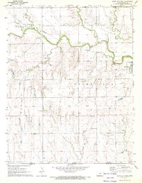
1971 Map of Bluff City West
USGS Topo · Published 1972About this map
Bluff City sits at the edge of this prairie landscape in Harper County, where the agricultural plains meet a network of meandering waterways. The map illustrates a rural economy transitioning into the 1970s, evidenced by the scattered Oil Wells and the Wilcox Landing Field located just south of the winding Bluff Creek. This region is defined by its drainage system, including Silver Creek, Wildcat Creek, and Bush Creek, which carve through the terrain and create complex contours across the townships of Stohrville and Spring.
Find a feature on this map
19 named features on this map. Tap any name to fly to it.
Don’t see what you’re looking for? This feature index may not catch every label — zoom into the map to look around manually.
Map Details
Editions of this 1971 Bluff City West Map
This is the sole edition of this map. No revisions or reprints were ever made.
Other maps of this area

1889 · Anthony
USGS Topo · 1:125,000

1889 · Caldwell
USGS Topo · 1:125,000

1891 · Anthony
USGS Topo · 1:125,000

1893 · Caldwell
USGS Topo · 1:125,000

1897 · Caldwell
USGS Topo · 1:125,000

1955 · Wichita
USGS Topo · 1:250,000

1955 · Enid
USGS Topo · 1:250,000

1955 · Woodward
USGS Topo · 1:250,000

1955 · Pratt
USGS Topo · 1:250,000

1958 · Enid
USGS Topo · 1:250,000